New Maps and Analysis Added! Explore the various spatial analysis and mapping projects that I have investigated since Spring 2012 through my GISc studies, based at the City University of New York: Lehman College. I have mapped natural hazards (earthquakes, flooding, and landslides) and natural and built world environmental problems (food deserts, habitat fragmentation, and air quality) using various GIS programs and operations. The maps highlight my continual improvement and refinement in both spatial analysis and cartographic display, with the most recent maps at the gallery's beginning. Contact me for downloadable copies of these maps.
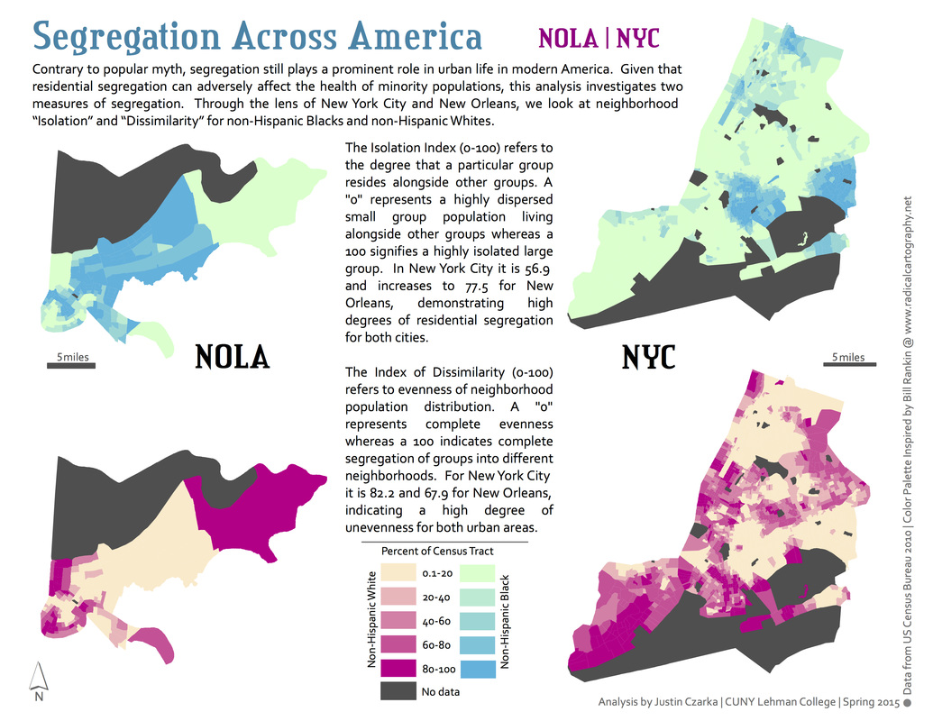
Segregation
Across America
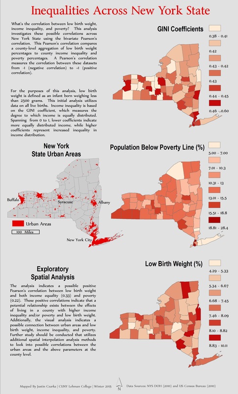
Inequality and Poverty
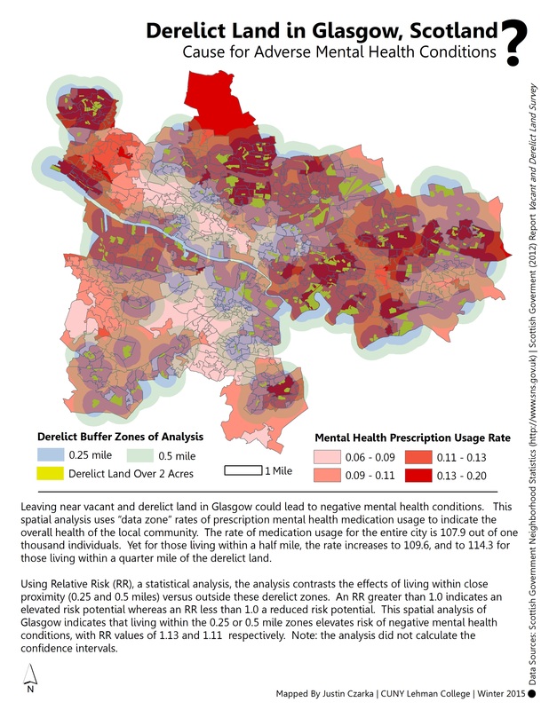
Derelict land and mental health
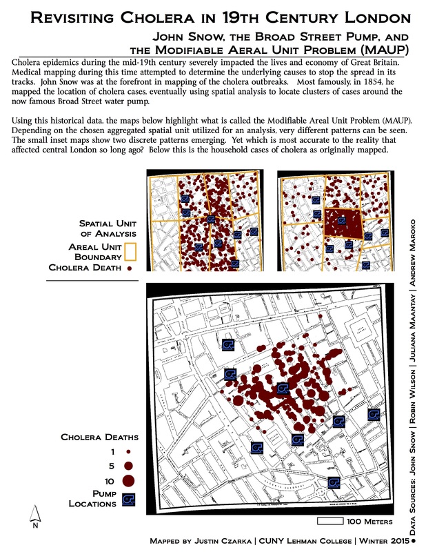
John Snow, Cholera, and MAUP
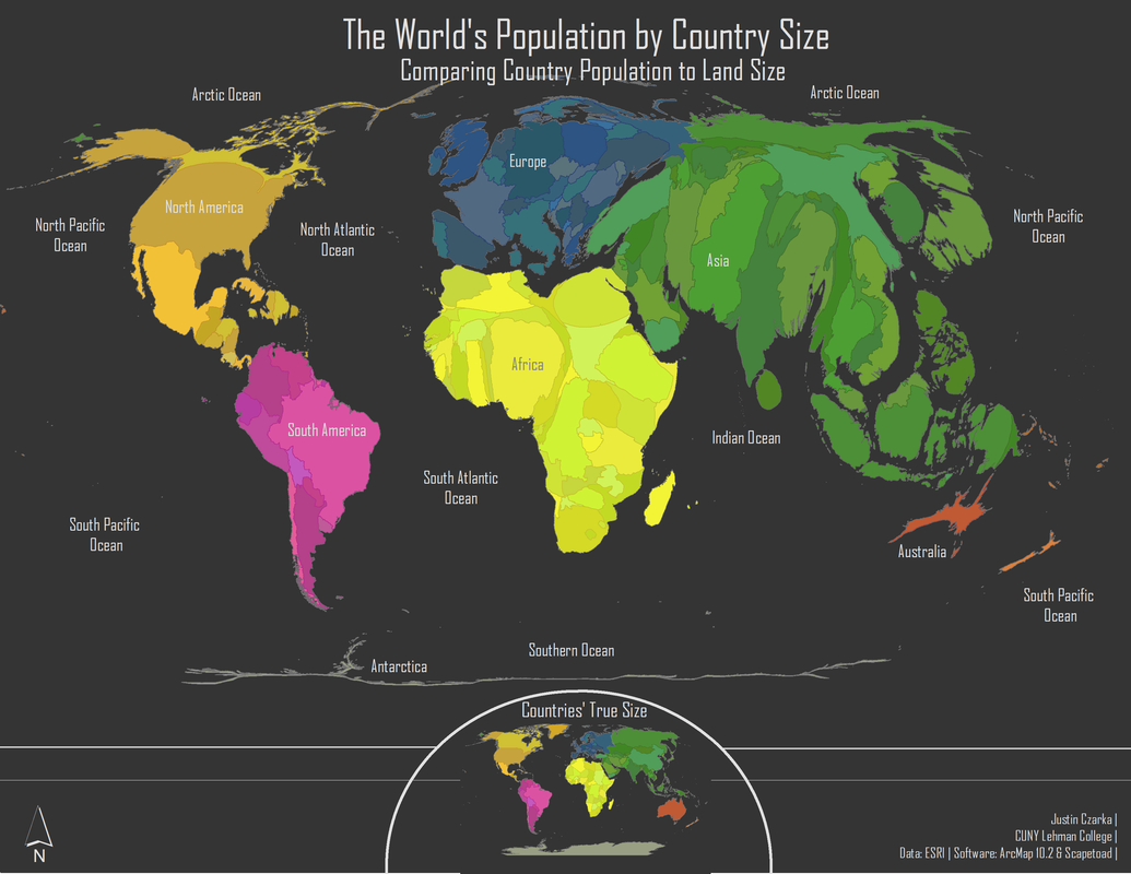
World Population Cartogram
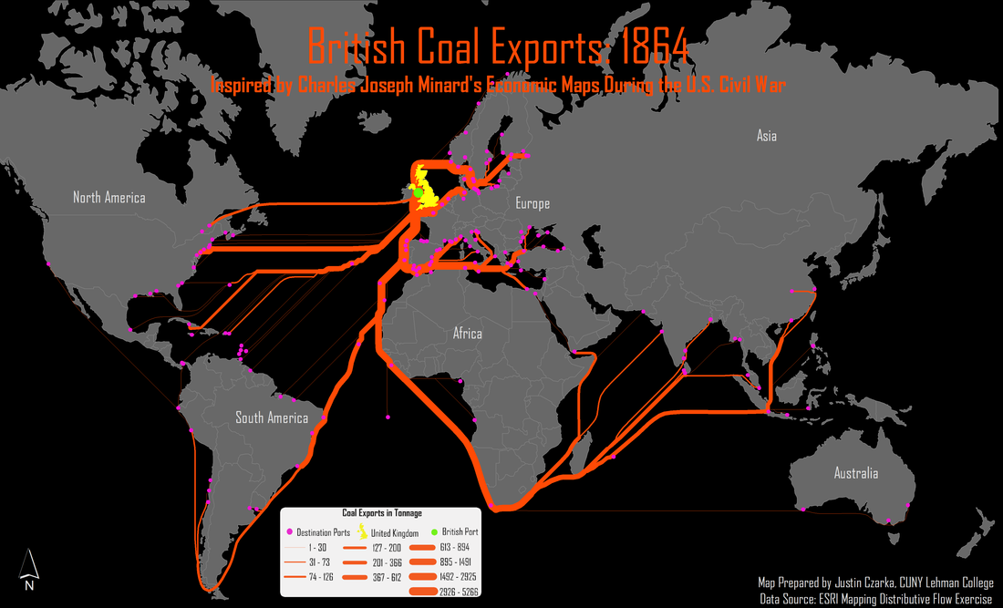
Historic Flow Mapping
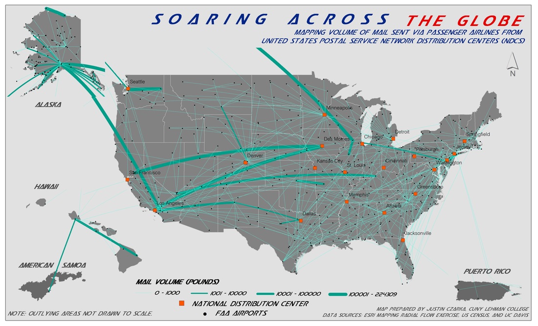
Airline Mail Volume Flow Mapping
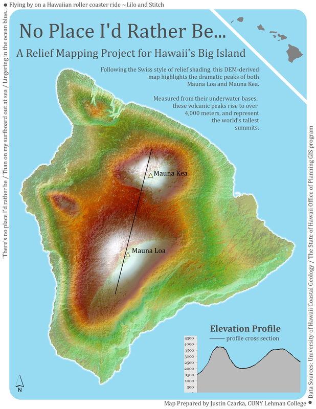
Relief Mapping IN HAwaii
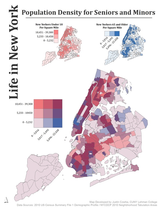
NYC POPULATION
BiVARIATE MAPPING
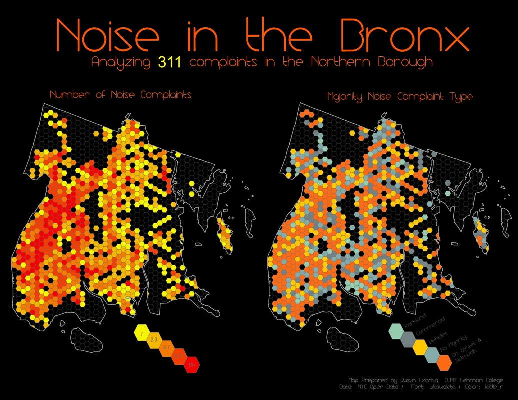
Bronx 311 Complaints
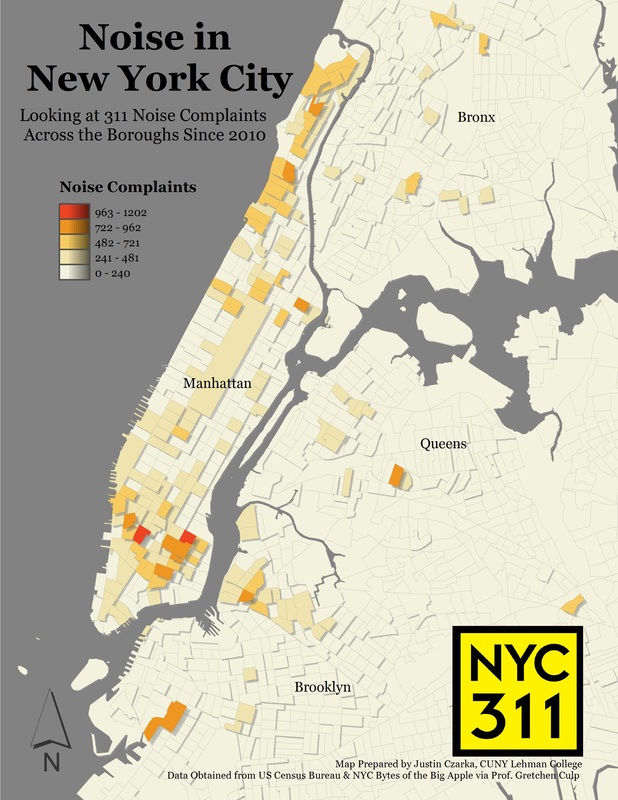
NYC Noise Complaints
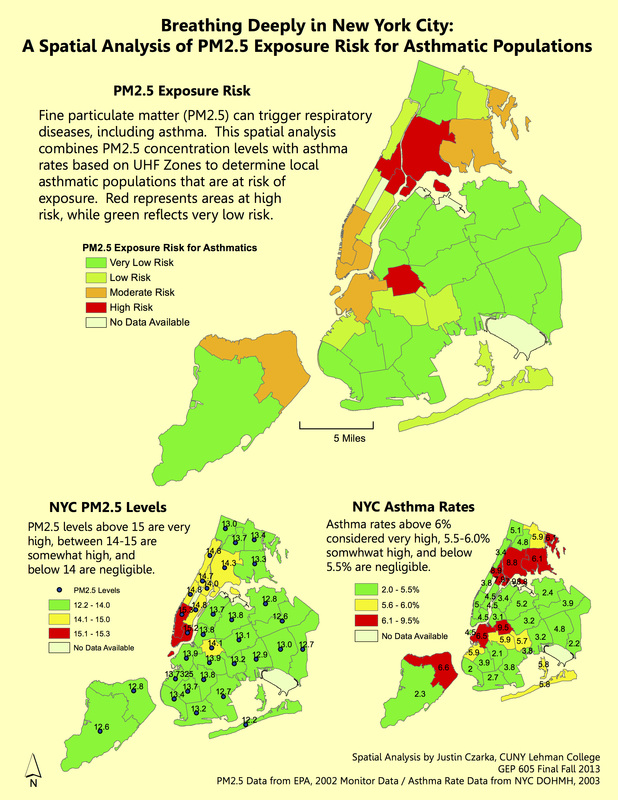
nyc asthmatic risk spatial analysis
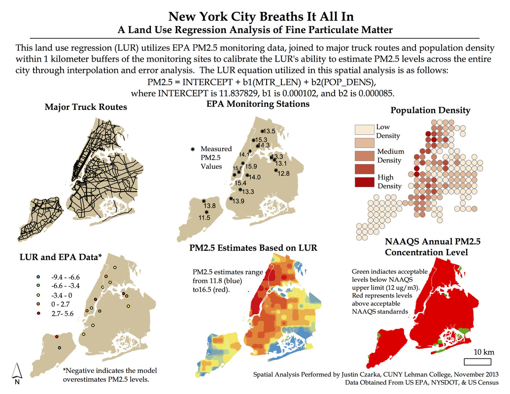
fine particulate matter mapping
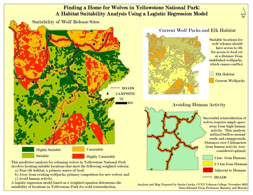
wolf habitat suitability analysis
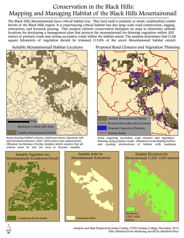
managing habitat fragmentation
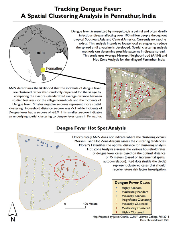
tracking dengue fever vectors
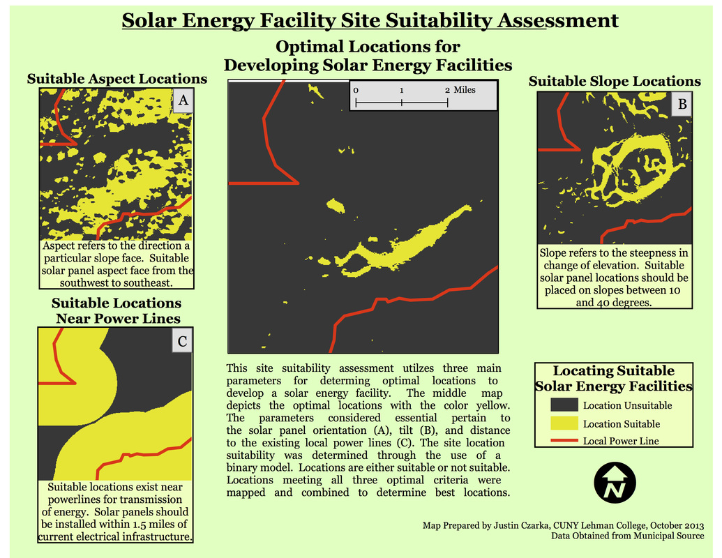
Site suitability assessment
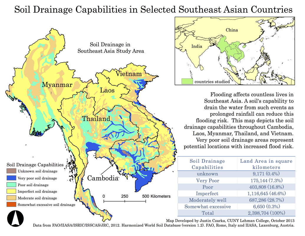
soil drainage and flooding analysis
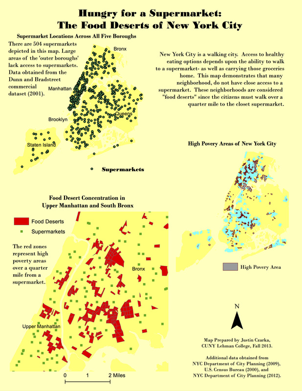
food desert mapping in new york city
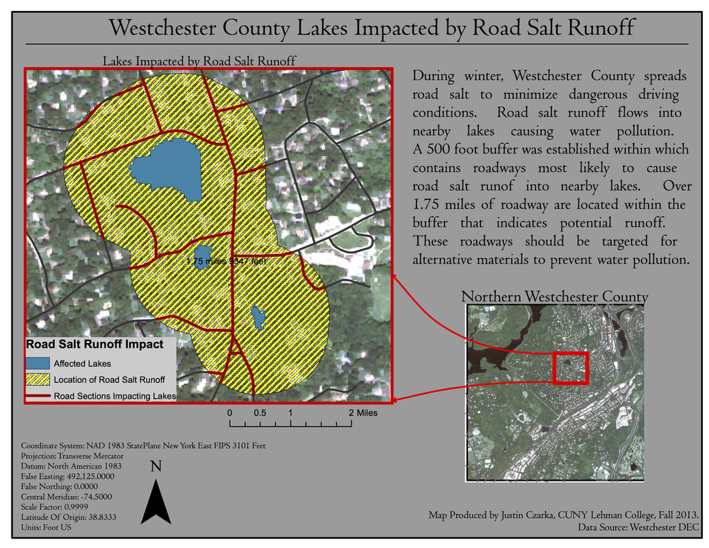
minimizing road salt runoff pollution
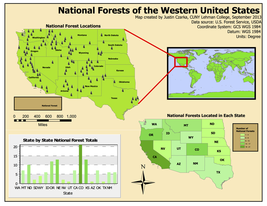
mapping U.s. national forests
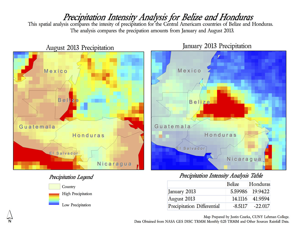
comparing precipitation
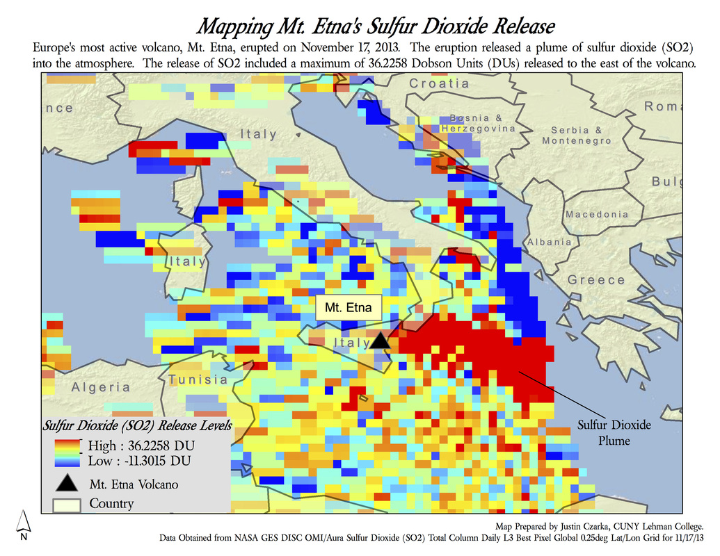
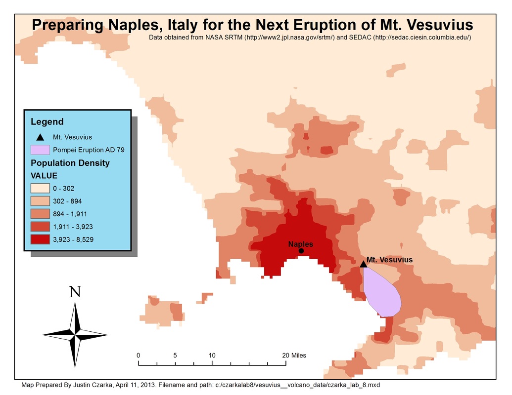
atmospheric impact: volcanic eruptions
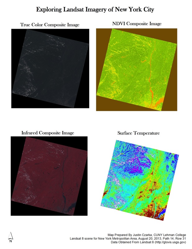
Remote sensing: Landsat imagery
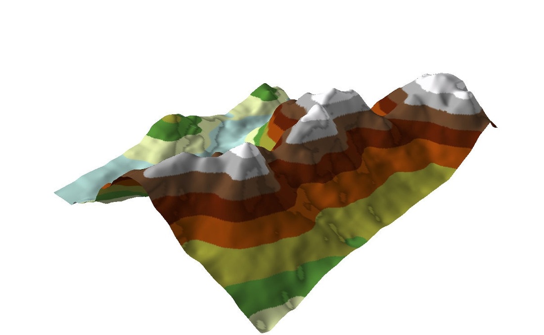
3d terrain modelling
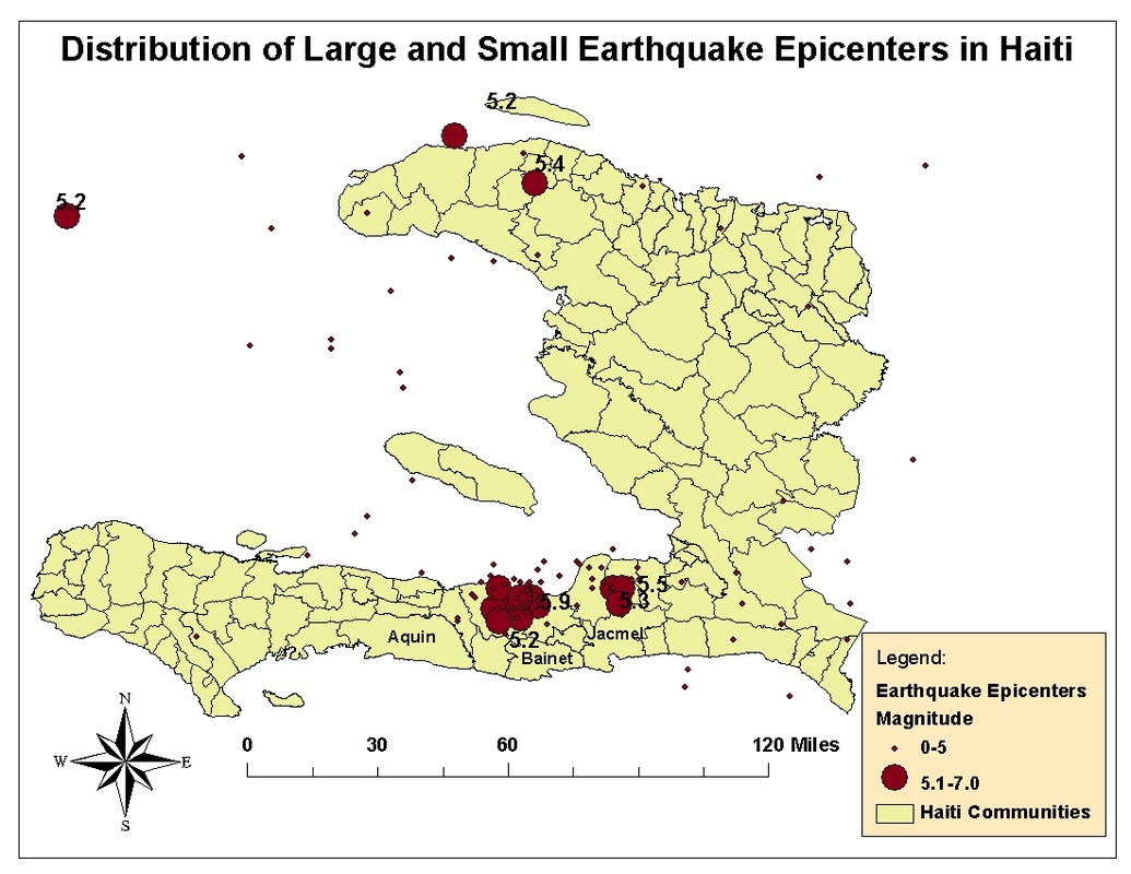
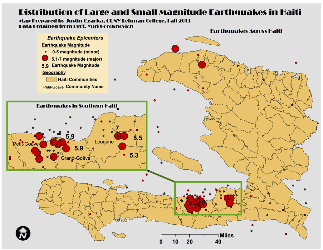
earthquake distribution in haiti
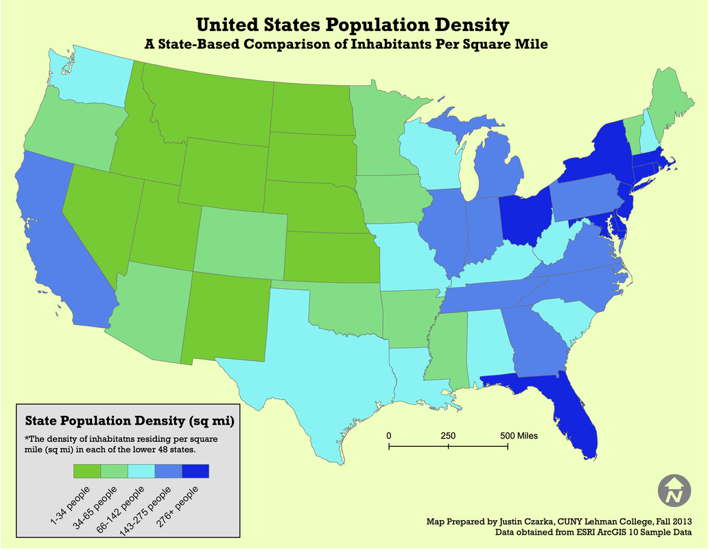
Population density
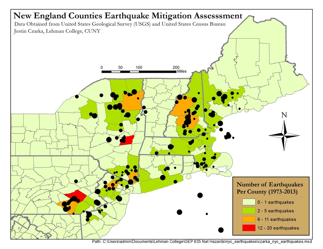
assessing earthquake mitigation
mitigating
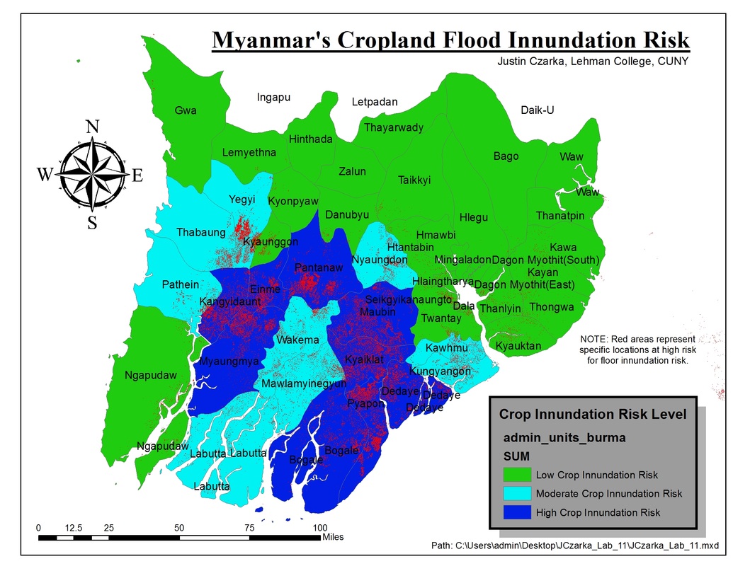
flood risks
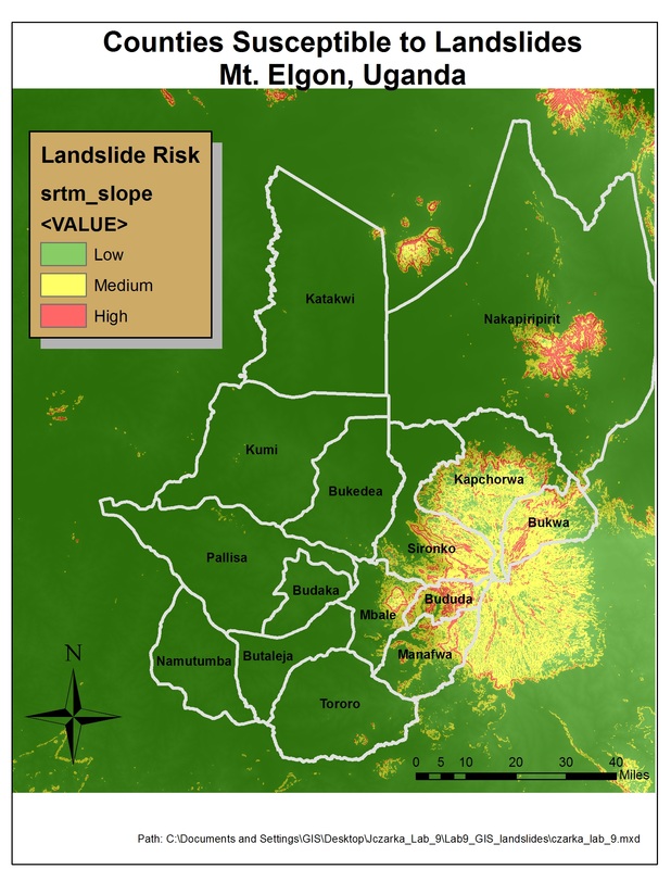
assessing landslide susceptibility
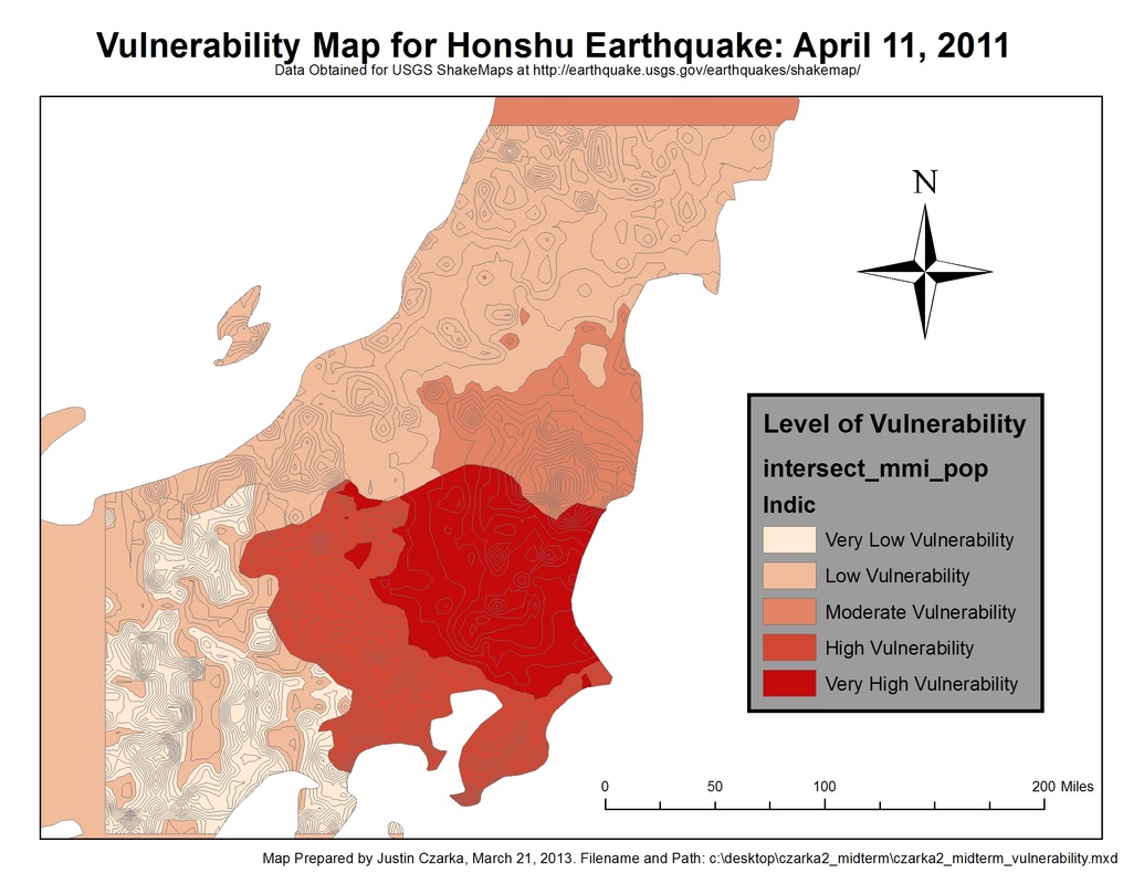
predicting earthquake impacts
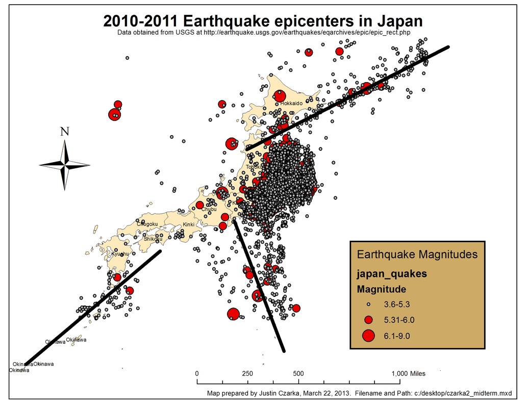
Mapping
epicenters in Japan
earthquake vulnerability mapping
Prioritizing aid after recent haitian earthquakes
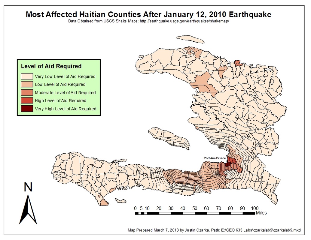
Mapping recent earthquakes in haiti